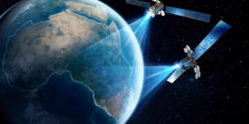








There’s a growing constellation of satellites quietly circling the Earth right now, capturing images and data that are changing how we understand our planet. Work that used to mean sending researchers into the field for months can now be tracked from space in near real time. That shift alone is reshaping environmental and ecosystem monitoring as we know it.
In simple terms, satellites work by picking up various wavelengths of light and radiation bouncing off or radiating from the Earth’s surface. This lets them detect things invisible to the naked eye, small changes in vegetation health, shifts in water quality, drops in soil moisture, patches of deforestation, even minor temperature fluctuations across oceans and land. And thanks to infrared and microwave sensors, they can keep an eye on things day or night, rain or shine.
The biggest advantage, really, is scale. One satellite pass can cover thousands of square kilometres in minutes, work that would take ground teams weeks, sometimes months, to pull off manually. That’s how we’re now able to track deforestation happening in the Amazon, catch coral bleaching as it unfolds, or watch glaciers retreat, all without anyone physically being there.
This technology has quietly transformed conservation work. Teams tracking illegal logging, poaching routes, or wildfire spread now rely on satellite imagery as a matter of course, since it allows them to respond far quicker than they used to. In Africa specifically, satellites are already proving useful, tracking desertification in the Sahel, monitoring the steady shrinking of Lake Chad, and watching over the Congo Basin’s rainforests. In these regions, physically getting a team there isn’t always straightforward or safe.
Farmers are benefiting too. Many agribusinesses now use satellite data to keep tabs on crop health, forecast yields, and spot drought stress before it’s even visible from the ground. That early warning can be the difference between a rough dry season and a genuine food security crisis.
That said, it’s not a perfect system. High-resolution satellite data still comes at a cost, and turning raw data into something useful takes specialised skills and infrastructure that not every country or organisation has ready access to. And even when the imagery is there, getting the right people to actually act on it is a whole separate challenge.
Speaking on the growing role of this technology, Benjamin Pius, CEO and Publisher of Broadcast Media Africa (BMA), said:
“Satellite data has quietly become one of the most powerful tools we have for understanding what’s happening to our environment in real time. For Africa especially, where ground access can be limited and resources stretched thin, this kind of technology levels the playing field. It gives us the ability to see problems as they emerge, not months after the damage is already done. The opportunity now is making sure this data reaches the people and communities who need it most, not just the organisations that can afford it.”
Even so, as more satellites go up and data becomes easier to access through open platforms and partnerships, that barrier keeps shrinking. Governments, NGOs, and private companies are finding more ways to work together, pooling resources so this view from above reaches the people who need it most.
In a lot of ways, satellite monitoring has quietly become the planet’s early warning system, one that never sleeps, never takes a day off, and never really stops watching.
This conversation, and others like it, will be front and centre at the upcoming Satellite & Space Infrastructure and Investment Summit- Africa 2026 taking place on 16th November 2026 in Cape Town, South Africa, where industry leaders will gather to explore how technology continues to reshape environmental monitoring, media and broadcasting across the continent.